Days 180-192
September 27-October 9
Monson, Maine, and the 100-Mile Wilderness
to
Mt. Katahdin, Maine
Day 180
Monson, Maine, to Cloud Pond
I had made it to a trailhead just outside of Monson, just before it started to rain, and just in time to catch a shuttle into town. I stayed at Leapin Leana's that night. It was still raining hard in the morning, and I decided to spend a second night in town. I moved over to Shaw's Hostel the following day. Shaw's is both a Hostel and an Outfitter. I purchased food for my push through the 100-Mile wilderness. I made a quick supply inventory as I was packing and discovered that I had forgotten to buy coffee. I went back to the Outfitter, bought coffee, and made arrangements for a food drop at the 50-mile point of the 100-Mile Wilderness. There is an old logging/fire road that intersects the AT at that spot. Shaw's provides a food drop at this location, for a fee of course.
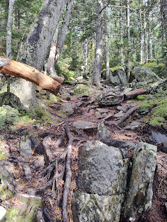
This trail section is nothing but roots, rocks, and more roots. Hiking through this spiderweb is extremely strenuous and dangerous. This area is definitely full of potential ankle breakers.
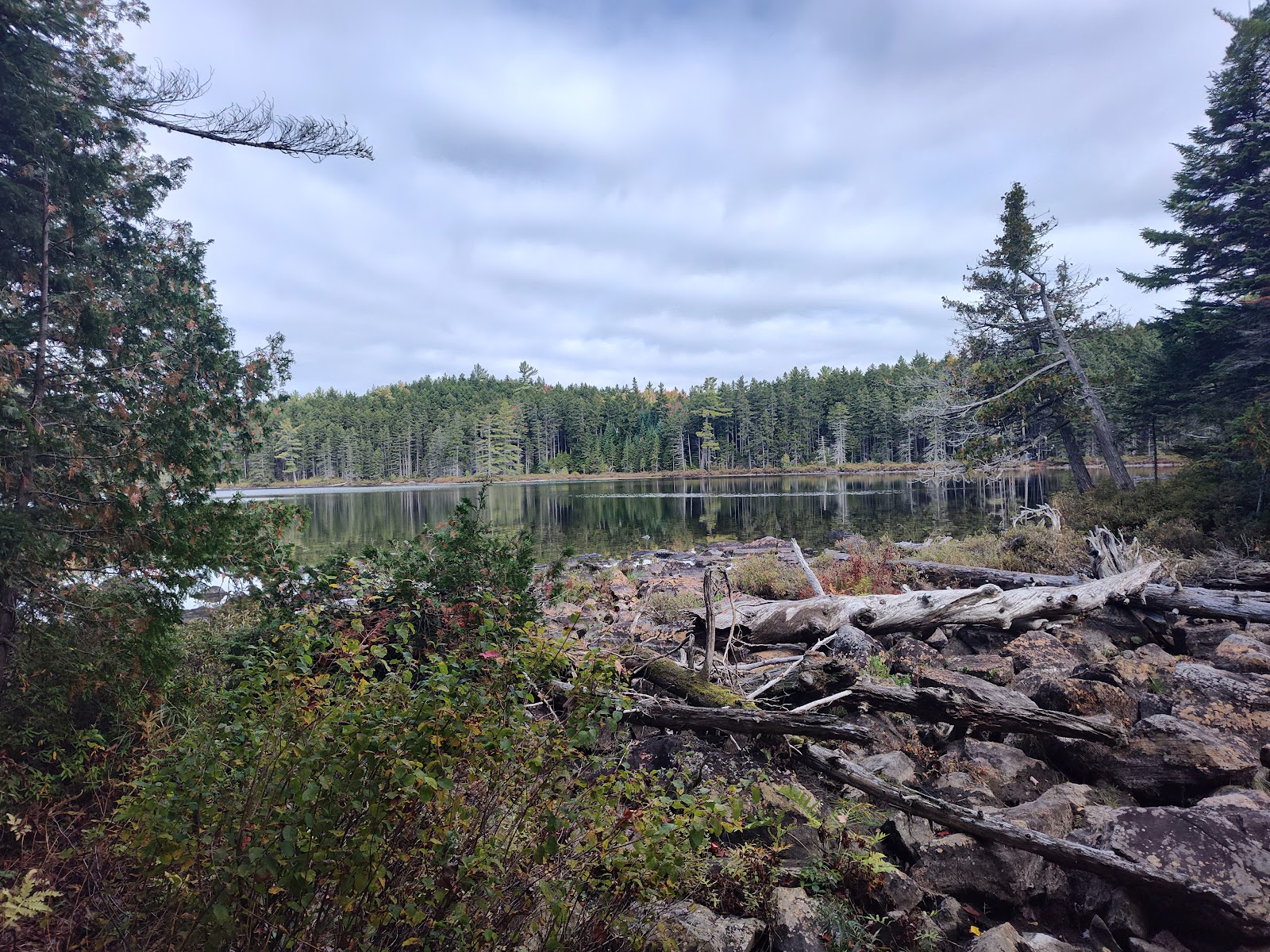
I arrived at Cloud Pond in the dark, pitched my tent, and made dinner. I was falling asleep and dropping my phone as I made these notes.
Day 181
Cloud Pond to Stealth Camp at West Chair Back Pond
I awoke to fog and a light drizzling rain. I made breakfast, took down camp, and hit the trail. While the landscape looks like a nice soft bed of green, it's actually moss and grass concealing rocks and roots. It is pretty to look at.
Today was not my day. The hike was on wet, muddy, slippery rocks and roots, and it was steep with a LOT of rock scrambling. All of this fun was happening while it was raining.
I came across an old plane wreck. The story goes that a man and his son were flying supplies to their cabin when the plane's engine died. They crashed and both survived. They came down in the forest and hiked out the next day. That's pretty remarkable given that the forest is so dense in this area.
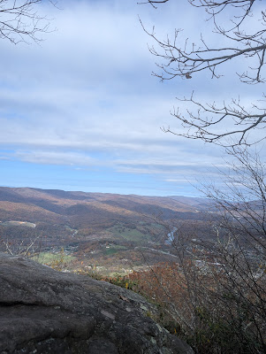
I found a nice, reasonably flat spot near the West Chair Back Pond. As I was making camp, the sun came out, and I could see the beautiful valley and mountains surrounding me.
Day 182
West Chair Back Pond to Stealth Site at Mile 2115.9

The weather was overcast and in the high 60s. There was just enough of a nip in the air to need my pullover for a while.
The trail dropped through a nasty rock slide. One slip, and you're going to fall a long way into some very jagged rocks. The climb isn't that difficult; there is just a lot of exposure. Hiking through this kind of terrain solo is a bit disconcerting. If I were to fall and get hurt here and slide down into a deep hole, it could be a long time before someone found me.
I couldn't find a good stealth site. I ended up camped in the only semi-flat spot I could find. My tent was wrapped around rocks and trees, and there was a big root in the middle of the tent floor. I was glad I had my freestanding Nemo Dragonfly tent; this definitely is no place for a Durston hiking pole tent.
Surprisingly, I slept well. It pays off having a Nemo Tensor sleeping pad -- it smooths out all of those imperfections.
I forded West Pleasant River. I looked for a spot to rock hop across, but none were to be found. The water was cold and came up to my knees at the deepest point. Even though the rocky bottom was slippery, this was an easy ford.
I passed a trail sign that said 83.9 miles to the top of Mt. Katahdin. The top and trail's end are near.
I'm five miles behind schedule for my food drop in two days. I tried to make up a mile or two by passing by designated campsites and hiking into the evening. When it started getting dark, I started looking for a flat stealth site. None were to be found. Here I am with my tent wrapped around another tree and big root. I still slept comfortably.
Day 183
Stealth Site at Mile 2115.9 to East Branch Lean-to
I have a Big Agnus 3-in-1 sleeping bag with inner and outer bags. In the middle of the night, I managed to tear a hole in my down outer bag. The zipper for the inner bag caught on the outer bag. When I pulled the inner bag up, disaster. Down was flying everywhere.
I collected down the best I could and pushed it back through the tear. Luckily I was carrying nylon repair tape. I would like to say, good as new, but now my pretty down sleeping bag has a battle scar.
Nice weather -- sunny with blue skies. I climbed White Cap Mountain (3,644 feet). The AT runs generally down from here all the way to the base of Mt. Katahdin.
I have to make my food drop tomorrow, so I hiked until 9:00 p.m. with the headlamp. Hiking in the dark was a bit tricky. It's hard for me to see what I'm walking on because the shadows caused by my headlamp obscure holes, rocks and roots.
Day 184
East Branch Lean-to to Lower Jo Mary Lake
 |
| East Branch Lean-to |
Food drop today. Time to meet the food delivery I had arranged for from Shaw's Hostel. I arrived at the designated spot 15 minutes early, but lots of other folks arrived sooner. I ended up being the last person to arrive.
The previous day I had texted Shaw's that if I didn't make it on time, they should bring my food to the drop point the following day. Because I was "late/last," the food drop driver assumed that I wasn't coming out and gave away a beer that I had requested. I had been thinking about that beer for five miles. Hiker hunger causes you to fixate on food and drink. He apologized, but there was no getting back my beer.
I hiked for an additional three miles and camped at Lower Jo Mary Lake. I ate my dinner and most of the snacks I had packed in my food drop. I was definitely in the full throws of hiker hunger and was ready to eat whatever was available. This is dangerous because if you eat all of your food you don't have anything until you can get somewhere to restock.
I decided to take a nearo (near zero/half day off) at Lower Jo Mary Lake. It was a great location. I watched the sunrise over the lake, drank my coffee, and decided to sleep in.
I am fighting some serious hiker hunger. I spend most of my time thinking about food. My food drop was yesterday, and I had lots of extra food. I ended up eating a good portion of it while looking online at menus for restaurants in Millinocket, the town located a few miles outside Baxter State Park at the northern end of the 100-Mile Wilderness. I didn't start hiking until 3:00 or so. I did get a few miles in before dark.
Mt. Katahdin overlooking Rainbow Reservoir
The trail today was badly eroded in many spots, leaving a web of gnarled tree roots, rocks, and mud.
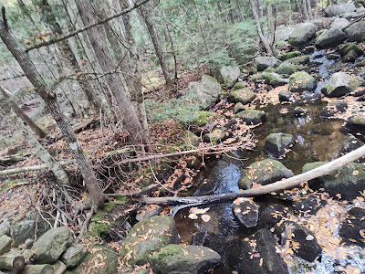
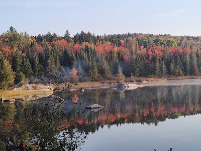
Beautiful fall colors are out, reflected on the streams, lakes, and ponds. A lot of leaves have fallen on the ground, covering the trail, making it hard to follow and obscuring obstacles.
I lost the trail four times due to leaves obscuring the trail, multiple trail crossings, and very few white blazes. I ended up backtracking about a mile. There was a lot of downfall across the trail.
Day 187
Rainbow Lake Dam to Abol Bridge
and the end of the 100-Mile Wilderness
Great weather today -- clear skies and warm. The trail started out a bit rough but changed to a nice cruise as I got closer to Abol Bridge.
I lucked into some trail magic just before the bridge. A couple of previous thru-hikers were offering thru-hikers meatball sandwiches and beer (I finally got my beer). I'm not normally a beer drinker, but that ice-cold PBR hit the spot.
The view of Mt. Katahdin was breathtaking, even though the top half of the mountain was obscured by clouds.
I didn't have to wait long for the Appalachian Trail Hostel shuttle, which picked me up and took me to the hostel, located in Millinocket, Maine. I arranged to stay there until Sally and our dogs arrived in town.
Days 188-190
Millinocket, Maine
Sally and our dogs (Rocky, Zap, and Rosie) arrived in Millinocket on Sunday, October 6th, and picked me up at the Appalachian Trail Hostel.
We stayed at a small, dog-friendly motel on the outskirts of town. Sally's main criterion for a place to stay is dog friendly--we'll just leave the rest of the accommodations criteria there, but it worked out well for us.
We spent a couple of days as tourists in Millinocket and the surrounding area that borders Baxter State Park.
 |
| Appalachian Trail Cafe (home to amazing homemade donuts) |
We used our time before the climb to secure our Baxter State Park entry permit, visit the Park, wash clothing and gear, and indulge in local cuisine.

 |
| Angelo's Pizza, Millinocket (He's served many a thru-hiker.) |
Abol Bridge/Blueberry Ridge Trail
Baxter State Park




Katahdin Kritters took great care of the dogs for a couple of nights so that we could access Baxter State Park. They even sent photos of the dogs enjoying their stay.
Tuesday, October 8th, had originally been the day I meant to summit Mt. Katahdin, but the weather report predicted a better day on Wednesday. As it turned out, we had a beautiful afternoon for hiking on Tuesday. We hiked a few miles from the Abol Bridge Campground farther into Baxter State Park.
 |
| View of Mt. Katahdin Day 192 Ascent of Mt. Katahdin |
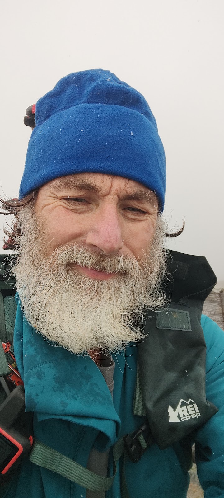
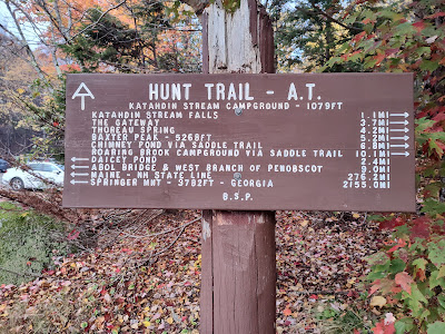
Ascent day started very early. We had a parking pass for the Katahdin Streams Campground parking area where the Hunt Trail, the official AT route up Katahdin, begins. However, any parking passes not claimed by 7:05 a.m. are given away. The Baxter State Park entrance opened at 6:00 a.m., and we were in line then, together with many others. We made the parking lot in time, and then as a thru-hiker, I was required to check in with a park ranger and listen to a safety talk. Sally and I began the hike up at about 7:30 a.m.
The weather prediction turned out to be a little backward. It was cloudy and chilly, then it began to rain, and as we neared the tree line, fat snowflakes began to fall.
With the exposed part of the climb ahead on a rock face that was becoming increasingly slippery by the minute, it became clear that Sally needed to turn around. As she began making her way back down the boulders of the Hunt Trail, I started the final ascent.


 |
| Mt. Katahdin Titanium at the Northern Terminus I made it!! |
Note from Sally:
I've never been the best at bouldering, but in the end, I was proud of myself for getting safely off that mountain! It took me a little over ten hours to hike seven miles (3.5 up almost to the tree line and then back down--the summit was about two miles farther up from the tree line). Due in great part to his having stayed with me for a few miles on the way up, Titanium finished the last hour and a half in the dark, coming down Abol Trail, an alternate, slightly shorter but steeper route off the mountain.
There was no cell service in the area. I made it to the car about a half hour before dark, and very soon two thru-hikers approached to ask if I was Titanium's wife. They were Somethin' and Sketch, and they delivered a message that Titanium would be coming down the Abol Trail to the Abol Campground, which was about two miles away from where I was parked at Katahdin Streams Campground. Titanium had offered them a ride to Millinocket, so I happily made room for them as we drove to Abol Campground to wait.
It got darker and darker, and I had no phone reception to even receive a message from Titanium's Garmin. After about an hour, another thru-hiker made it down and asked if I was Titanium's wife. Yes, indeed! He delivered a message that Titanium was about a half hour behind him and had also offered him a ride to Millinocket because he thought he had missed his shuttle. We all squeezed in together to wait.
Before long, we could see Titanium's headlamp bobbing down the trail. Victory! And a very convivial group of hikers who had summited in the snow that day. As it turned out, the last hiker's shuttle arrived after all, but we enjoyed Somethin' and Sketch's company for a drive-through dinner at McDonald's in Millinocket. Congratulations to all!

EPILOGUE
HOME, A TRIP TO VIRGINIA, & A FINAL NOTE
 |
| Many thanks to Brent & Laura McGavin for this surprise welcome home! |
You may remember that the plan had been for Sally to drop off Titanium and Rocky on the way home so that they could hike some AT miles in southern Virginia that Titanium had missed while injured in June. Mother Nature had other plans however. Hurricane Helene, which struck the weekend of September 28th, left devastation in its wake, reaching all the way into southern Virginia and severely affecting both the trail itself and the infrastructure all around. After Titanium checked with several hostel owners and shuttle drivers in the area and finally consulted with the Appalachian Trail Center in Damascus, which did not reopen until October 14th, it became clear that it was best to stay off the AT in southern Virginia for a while.
In late October, we did take a weekend hiking trip to Pearisburg, Virginia, to hike a few miles on the AT and enjoy the big tent accommodations, communal organic food, and ultimate dog-friendly atmosphere at Wood's Hole Hostel. This is a place to which we would all like to return, and we very well may in the spring when hopefully the trail will be fully accessible again. We did leave Zap, our 13-year-old dog, behind at a boarding kennel this time, and Rosie experienced her first backpacking trip . . . and met her first goats!
Hiking the Appalachian Trail was a great adventure that wouldn't have been possible if it were not for the support of my wife Sally. She handled most of the logistics, food drops, picked me up when I was injured, picked up Rocky when he was injured and the trail got to be too much for him, visited me/Rocky along the trail, all while handling her job, everything at home, the cabin, and our apiary (beehives), and she kept this blog current. Thank you, Sally. Your turn is coming up soon.
I've been asked what is the best part of the hike. Finishing was definitely high on the list, as were the views and the daily adventures. I have to say that the absolute best part of the hike was the people I met along the way, ranging from the folks providing trail magic, the people who shared their life's experiences, hostel, shuttle, and outfitter crews, friends who came out to meet me along the trail, and those I met along the way and hiked with. I have to say that the times I spent with Commando, Slugger, and Rocky, the best trail dog ever, were particularly enjoyable. I just wish I could have hiked a bit faster, but that wasn't in the cards. It all comes down to everyone hikes their own hike, and I definitely did.
I hope you all enjoyed following our adventures as we hiked the Appalachian Trail. And yes, there will be more adventures to come. For me, retirement doesn't mean sitting on my laurels and watching life go by.
Regards --
Titanium (AKA Dan Goade)
email: dgoade2@aol.com


















Bravo for doggedly trekking to the summit of a snowy Mt. Katahdin and back down in the dark that terminal day. Not a journey for the weak of heart. Congratulations brave warrior!
ReplyDeleteThanks Jim. There's nothing like adventure to let you know you're actually living your life.
Delete